You might also like these products
C-Map Reveal Charts NZ
Simrad
$379.00
Quantity
Add to cart
C-Map Reveal NZ, Chatham Island, Kermadec
Works with compatible Simrad, Lowrance and B&G Chartplotters
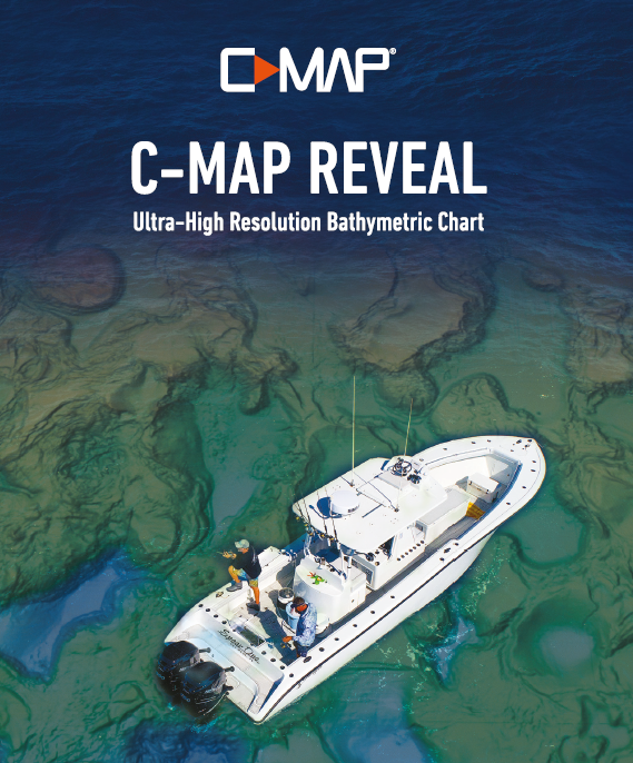
- Enter a new world of mapping with C-MAP Reveal. View the sea floor in a new light and clearly identify sea floor structure, along with reefs and ledges to find the best fishing and diving spots. C-MAP Reveal will take your charts to the next ultra-high resolution level.
- These world-class vector charts include all navigation information, ranging from depth areas and contours, spot soundings, navigation aids, moons, tides, currents, marine parks and more.
- Attractive three-dimensional views of land elevation and bottom contours bring to life the world around your boat. Visualise underwater pinnacles and topographical landmarks easier than ever.
- With custom depth shading, you can configure color palettes to highlight custom-depth ranges. If you've found fish in a certain depth, you can easily identify other similar areas on your chart by highlighting the depth range.
- Unlock previously hidden secrets of your favourite water body. Turning Genesis layer on with your C-MAP Wide or Local chart reveals contour detail as accurate as 1 foot intervals. See humps, ditches and drop offs that went unnoticed before, helping you identify new fish-holding structure to investigate.
Information:
Contact:
07 577 0250 50A Cross Road, Unit 1, Sulphur Point, Tauranga
Visit us in store
Monday to Friday 8am - 5pm